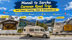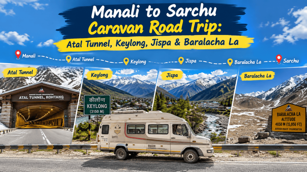
The drive from Manali through the Atal Tunnel into Lahaul Valley is one of the most dramatic road journeys in the Indian Himalaya. In less than an hour, green forests and busy tourist towns give way to dry, rugged mountains, glacier-fed rivers, quiet villages and one of the highest motorable passes in Himachal.
This guide follows the route Manali → Atal Tunnel → Sissu → Gondhla → Tandi → Keylong → Jispa → Darcha → Zingzing Bar → Baralacha La, with an optional continuation to Sarchu. It focuses on Lahaul itself rather than a rushed run to Leh, and it is written for caravan travellers who want to stop, camp and enjoy the valley at their own pace.
Trip at a glance
| Route | Manali → Atal Tunnel → Sissu → Gondhla → Tandi → Keylong → Jispa → Darcha → Zingzing Bar → Baralacha La (→ Sarchu) |
| Distance | Manali to Baralacha La is roughly 190 km; Manali to Sarchu is about 220 km. Distances are approximate. |
| Suggested duration | 3–4 days at an easy pace, with overnight stops at Sissu or Keylong and Jispa |
| Best time | Roughly June to September. Baralacha La is seasonal and can close with snow, so check road status before you leave. |
| Highest point | Baralacha La at about 4,850 m |
| Ideal for | Caravan and self-drive travellers who want a scenic, slower Himalayan route without going all the way to Leh |
Distances, times and altitudes in this guide are approximate. Road conditions, weather and closures can change them.
Manali: the starting point
Manali sits at about 2,050 m, among deodar forests and snow-capped peaks. It is the best place to prepare for the journey: service your caravan, fill the tank, stock up on food and water, and pick up cash and any medicines you need.
Give yourself a night here if you are arriving from far away, so you begin the drive rested. The road ahead gains altitude steadily, and a gentle start helps your body adjust.
Manali → Atal Tunnel
From Manali the road climbs through Solang Valley towards the south portal of the Atal Tunnel. At roughly 9 km long, it is among the longest high-altitude road tunnels in the world, and it replaced the old, often snow-blocked route over Rohtang Pass for most of the year. Journey times between Manali and Lahaul have dropped dramatically since it opened in 2020.
The tunnel has its own rules, including speed limits and a ban on stopping. Follow the signs, keep a safe distance from other vehicles, and check beforehand whether any size or vehicle-type restrictions apply to your caravan.
Then you emerge on the other side, and the landscape has changed completely. The green slopes of Manali are replaced by dry, rugged mountains. This sudden contrast is one of the most memorable moments of the trip.
Atal Tunnel → Sissu
Just beyond the north portal lies Sissu, at about 3,100 m, on the banks of the Chandra River. The village sits in a wide valley ringed by snow peaks, with a waterfall dropping down the mountain opposite.
Sissu is an excellent first overnight stop, and it is a good place to start acclimatising. Take a walk, visit Sissu Lake and the waterfall, and enjoy the open views. The landscape changes with the seasons: it is white with snow in winter and spring and greener in summer.
Sissu → Gondhla
Continuing along the Chandra River, the road passes through traditional Lahaul villages with flat-roofed houses and prayer flags. Gondhla is known for its historic fort, a tall, multi-storey structure that shows how local chieftains once lived.
The villages here are quieter than Manali. They give you a chance to see everyday mountain life, with small fields, apple and potato farms and friendly locals, away from the tourist crowds.
Gondhla → Tandi
Tandi is where the Chandra and Bhaga rivers meet to form the Chandrabhaga (Chenab) River. The confluence sits inside a natural amphitheatre of mountains and is a quiet spot to pause.
| Fuel alert: Tandi is the most important fuel stop on this route. Keylong also has a pump. Fill your tank completely at Tandi or Keylong before heading on, because the next dependable pump on the highway towards Ladakh is generally near Karu, about 30 km before Leh and roughly 345 km later. Carry spare fuel for the high section, and check the latest pump status before you travel. |
Tandi → Keylong
Keylong is the main town and administrative centre of Lahaul. At about 3,100 m, it is the best place on the route to restock food, water and cash, and to see the local side of Lahaul instead of simply passing through.
Visit the nearby monasteries, including Kardang, Shashur and Tayul, walk through the town’s markets, or take in the views across the Bhaga Valley. Keylong is also a comfortable base for an easy overnight, with better services than anywhere further up the road.
Keylong → Jispa
From Keylong the road follows the Bhaga River towards Jispa, about 20 km further on. The valley narrows, the mountains rise higher and the scenery becomes more dramatic with every kilometre.
Jispa: the ideal caravan base
Jispa sits at about 3,200 m beside the Bhaga River, in a broad, green valley surrounded by huge Himalayan peaks. It is one of the best places in all of Lahaul for a caravan stop.
Instead of checking into a hotel, you can park beside the river, cook a meal, sit outside with a cup of tea and watch the light change on the mountains. It is also the best place to spend a night before the high section, since it is low enough for most travellers to sleep comfortably while they continue to acclimatise.
| Why Jispa matters: Jispa is low enough for good rest and high enough to count as acclimatisation. Using it as your overnight base before Baralacha La is far better than climbing straight to Sarchu in one go. |
Jispa → Darcha
Darcha, at about 3,350 m, is one of the last major settlements before the road enters truly remote terrain. It is also the starting point of the trekking routes towards Zanskar over the Shinku La, and the road to Padum branches off here.
Beyond Darcha the landscape becomes steadily more barren. Trees disappear, the mountains grow larger and the feeling of isolation sets in. This is where the trip turns into a real high-altitude adventure.
Darcha → Zingzing Bar
Past Darcha the road climbs steadily towards Zingzing Bar (about 4,300 m). The scenery is wild and rugged, with rock formations, big open slopes and few signs of human life. Along this stretch there are long periods in which you see only mountains, sky and the winding highway.
Altitude becomes a real factor here, so drive slowly, drink plenty of water and watch for headaches or unusual tiredness. If anyone in your group feels unwell, do not push on.
Look out for Deepak Tal, a small high-altitude lake, near this section of the road.
Zingzing Bar → Baralacha La
The final climb leads to Baralacha La (about 4,850 m), the high point of the Lahaul route. The pass lies between the Lahaul and Ladakh regions and is the source of several rivers, including the Chandra.
Weather here can change quickly. Snow, strong winds, freezing temperatures and poor visibility are all possible, even in summer. Always check the latest road and weather updates before attempting the pass, and cross it in the morning if you can.
A short distance beyond the pass lies Suraj Tal, a beautiful high-altitude lake worth a stop. The vast, silent scenery around it makes it one of the most memorable places on the entire trip.
| Road hazards on the high section: Expect narrow roads, loose surfaces, water crossings from melting snow (worse in the afternoon) and no mobile network. Keep your speed low, avoid night driving, and travel with sufficient fuel, food and water. |
Beyond Baralacha La: Sarchu
After the pass the road descends towards Sarchu, at about 4,300 m, on the border between Himachal Pradesh and Ladakh. The landscape becomes wide, open and strikingly empty, with huge plains ringed by high mountains.
Sarchu is a popular overnight halt for those continuing to Leh, but it is worth thinking twice. At about 4,300 m, sleeping here after climbing quickly from Jispa is a common cause of altitude sickness. If you are not already well acclimatised, consider using Jispa or Keylong as your overnight stops and treating Sarchu as a rest stop rather than a bed for the night. If you are continuing to Leh, read our Manali–Leh guide before you go.
Why travel this route by caravan?
Lahaul rewards slow travel, and a caravan is made for that.
- Stay where the views are: park beside the river at Jispa or the lakeside at Suraj Tal instead of racing to the next hotel.
- Acclimatise at your own pace: spend an extra night when you need it without worrying about bookings.
- Cook and eat on your terms: hot meals and tea are a real comfort at altitude and in cold weather.
- Carry everything you need: bedding, water, food and spare supplies, in one place.
- Flexibility: if weather closes a pass, you simply wait it out comfortably in your own vehicle.
Practical caravan tips for Lahaul
- Fuel: fill up completely at Tandi or Keylong, and carry spare fuel for the long stretch beyond.
- Vehicle size and power: roads are narrow with sharp bends. Engines lose power at altitude, so allow extra time and use engine braking on descents.
- Spares and tools: carry a spare tyre, puncture kit, foot pump, tow rope and basic tools, because mechanics are hard to find on the higher stretches.
- Cold nights: temperatures can fall below freezing even in summer. Carry proper bedding and insulation.
- Heater and generator safety: never run a heater, stove or generator in a closed caravan. Carbon monoxide is a serious risk, so keep ventilation open and use a CO alarm.
- Network and cash: mobile coverage is patchy beyond Keylong, and ATMs are limited. Carry cash and download offline maps.
- Parking and camping: rules vary by place. Ask local authorities or camp operators where overnight parking is permitted.
Best time to go and road status
The best window is roughly June to September, when Baralacha La is typically open and weather is most stable. The road beyond Keylong can close because of snow, landslides or water crossings, and the Atal Tunnel can also be affected by heavy snowfall in winter.
Opening dates change every year. Check current road status with the Lahaul-Spiti district administration, the BRO or local updates before you leave, and be prepared to wait or turn back if conditions are poor.
Suggested 4-day itinerary
| Day | Route | Approx. distance | Highlights and overnight |
| 1 | Manali → Atal Tunnel → Sissu | ≈ 50 km | Cross the tunnel, Sissu waterfall and lake; overnight at Sissu |
| 2 | Sissu → Gondhla → Tandi → Keylong → Jispa | ≈ 65 km | Gondhla fort, Tandi confluence, refuel, Keylong monasteries; overnight Jispa |
| 3 | Jispa → Darcha → Zingzing Bar → Baralacha La → Suraj Tal | ≈ 45–50 km each way | High-altitude day trip; return to Jispa to sleep lower |
| 4 | Jispa → Keylong → Manali (or onward towards Sarchu and Leh) | ≈ 135–140 km to Manali | Return the way you came, or continue only if well acclimatised |
This plan keeps your sleeping altitude low while you explore the high section during the day. Add an extra night at Jispa or Keylong for a slower trip.
Altitude sickness: what to know
Altitude sickness (AMS) can affect anyone, regardless of fitness. On this route you climb from about 2,050 m at Manali to nearly 4,850 m at Baralacha La within a couple of days, so it is worth taking seriously.
| Place | Approx. altitude | Note |
| Manali | 2,050 m | Start point |
| Sissu | 3,100 m | First stop after the tunnel |
| Keylong | 3,100 m | Restock; good halt |
| Jispa | 3,200 m | Best caravan base |
| Darcha | 3,350 m | Beginning of the remote section |
| Zingzing Bar | 4,300 m | Altitude starts to bite |
| Baralacha La | 4,850 m | Keep stops at the top short |
| Sarchu | 4,300 m | Common AMS spot; sleep lower if possible |
- Climb gradually, and sleep at Jispa or Keylong before going higher
- Drink plenty of water, eat light meals and avoid alcohol
- Headache, nausea, dizziness or breathlessness at rest are warning signs; do not go higher until you feel better
- If symptoms worsen, descend and seek medical help immediately
- Carry a small oxygen can and basic medicines, and consult your doctor beforehand if you have health conditions
Frequently asked questions
Can a caravan go through the Atal Tunnel?
Many large vehicles use the tunnel, but there are rules on speed, spacing and stopping. Check the latest guidance and any size or vehicle-type restrictions before you travel.
Where is the last fuel before Leh?
Fuel is generally available at Tandi and Keylong, with the next dependable pump near Karu, about 30 km before Leh. Fill up fully at Tandi or Keylong and carry spare fuel. Check the latest status before you travel.
Is Baralacha La open?
It is usually open from around June to September, but dates change every year. Check current road status before you set out.
Where should I stay overnight?
Sissu, Keylong and Jispa are comfortable options. Jispa is the best for caravans. Consider avoiding an overnight at Sarchu unless you are well acclimatised.
How many days do I need?
Three to four days is a good pace for Manali to Baralacha La and back, with Jispa as your base.
Do I need a permit?
Permit rules change, so check the latest requirements before you travel. Indian nationals have not needed an Inner Line Permit for the main Ladakh circuits in recent years, but fees and paperwork can apply, particularly if you continue into Ladakh.
Final thoughts
The Lahaul route is a journey through changing worlds: forest and fields around Manali, the dramatic opening of the Atal Tunnel, the river valleys of Sissu and Tandi, the peaceful riverside at Jispa, and the stark, high-altitude beauty of Baralacha La.
Manali → Atal Tunnel → Sissu → Gondhla → Tandi → Keylong → Jispa → Darcha → Zingzing Bar → Baralacha La → Sarchu
For travellers who want to experience the Himalayas rather than just reach a destination, this is a route best taken slowly, with a caravan and a flexible plan.